For never having heard of Rapid City, South Dakota before, it delivered an unexpectedly great time. There is construction all over the place and the city is clearly on the rise. Not only is there is a lot to do in the city, but the amount of great stuff within a relatively short driving distance made it even better. The icing on the cake was the awesome people that gave me a good reason to stay two extra days.
Friendly Street Corners


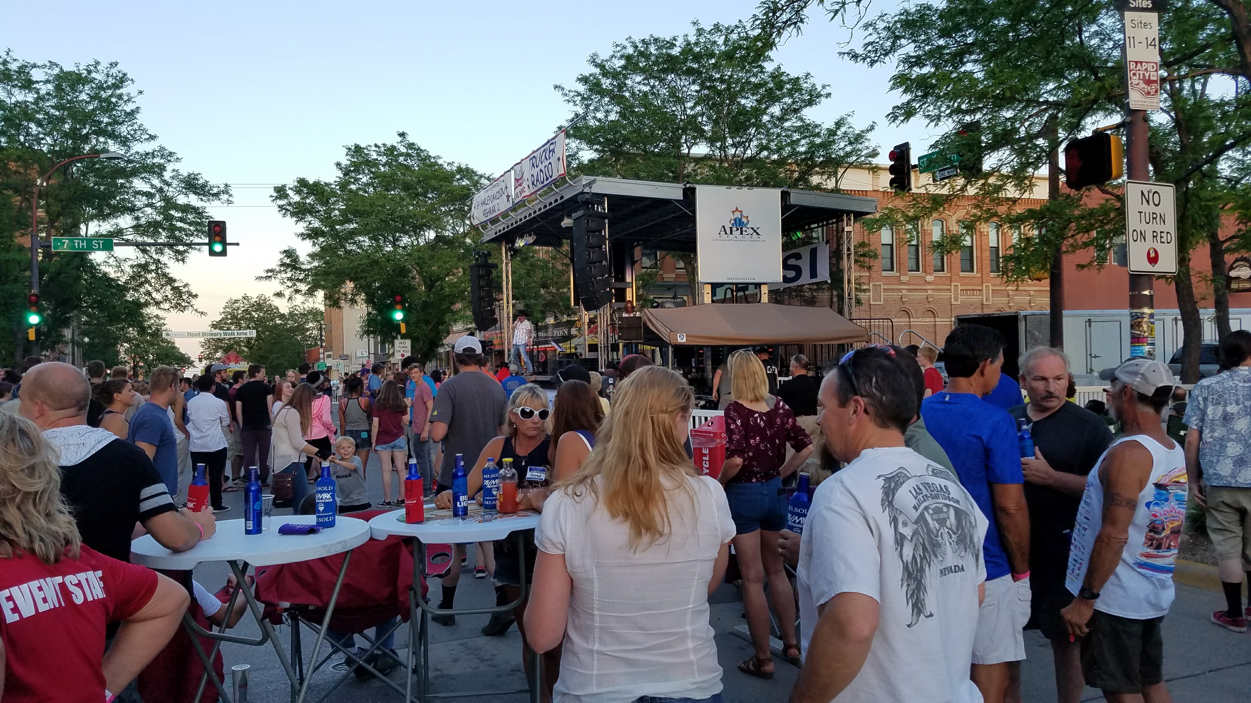
Western South Dakota, or more specifically Rapid City has been one of the most fun places I’ve been so far. Every week in the summer, they have a summer nights festival downtown where they have a local band play, food trucks, and loads of drinking and partying in the streets. Charlie and I met a ton of awesome people, had some great conversations, and ate a lot of great food. The people were so friendly that we all ended up hanging out on a street corner chatting until nearly midnight (the street party ended around 900). We were having so much fun that people ended up driving by, saw us having a good time talking, parking their cars, and coming to hang out. I snapped the above picture sometime around medium group size. I also happen to run in to some of the Flaunt Girls from Full Throttle Saloon. They aare regular performers at Sturgis (huge motorcycle festival) and other major motorcycle rallies. Admittedly, I had no idea who they were, but they were a lot of fun to talk to and had some great stories from their various performances.
Pine Ridge
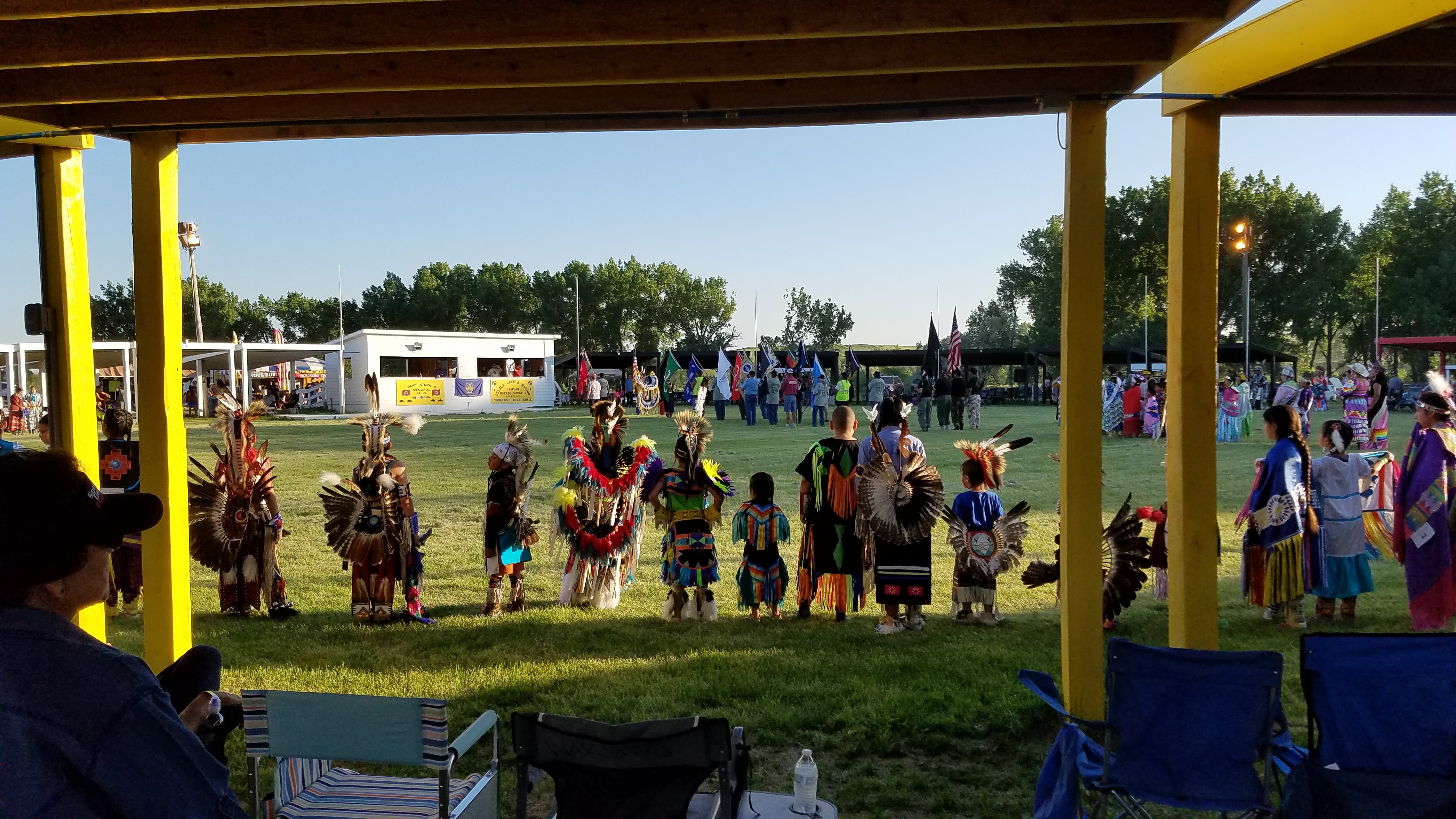 I was warned by quite a few people not to go to the Pine Ridge Reservation. The fact that it is amongst the poorest places in the US pushed the idea that there is a lot of crime and it’s an unsafe place to be. Not to be deterred, I went anyway though I wasn’t sure what to expect. Before I went in to the town, I figured I should take Charlie for a walk and searched for a park. I pulled in to the park to find what I would soon learn was the first pow-wow of the year. And as is traditional for the Oglala Sioux Indians first pow-wow, they hold it in honor of those who have passed, the elders, and the veterans. So I promptly went from being cautious to being an honored guest at the pow-wow. I ended up spending a lot of time sharing stories with other veterans from wars as far back as WWII all the way up to the most recent conflicts in Iraq and Afghanistan with every major conflict in-between represented. One of the members of the tribe’s father survived D-Day and then ultimately was responsible for creating the first code system based on the Sioux language. This was used by the US Army throughout the course of WWII. I ended up making quite a few friends and had a completely different impression of Pine Ridge. However, that didn’t take away from being able to see exactly how poor the community was. There were many people who had dilapidated houses originally built by the government. They were in such poor shape that the horses would live in the houses and families would live in teepees they built right outside their houses. It is a really sad state to see the conditions in which most of these people live but great to see them living happily as a united tribe through the struggle.
The Badlands, Again
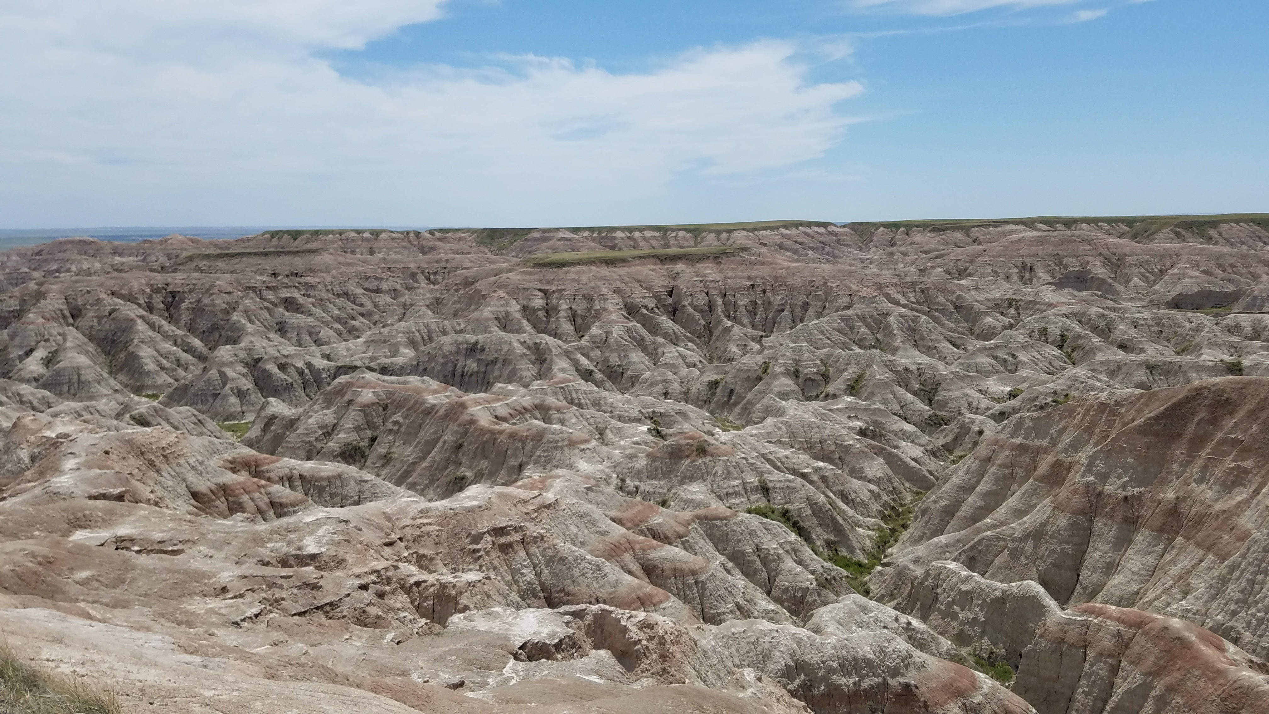
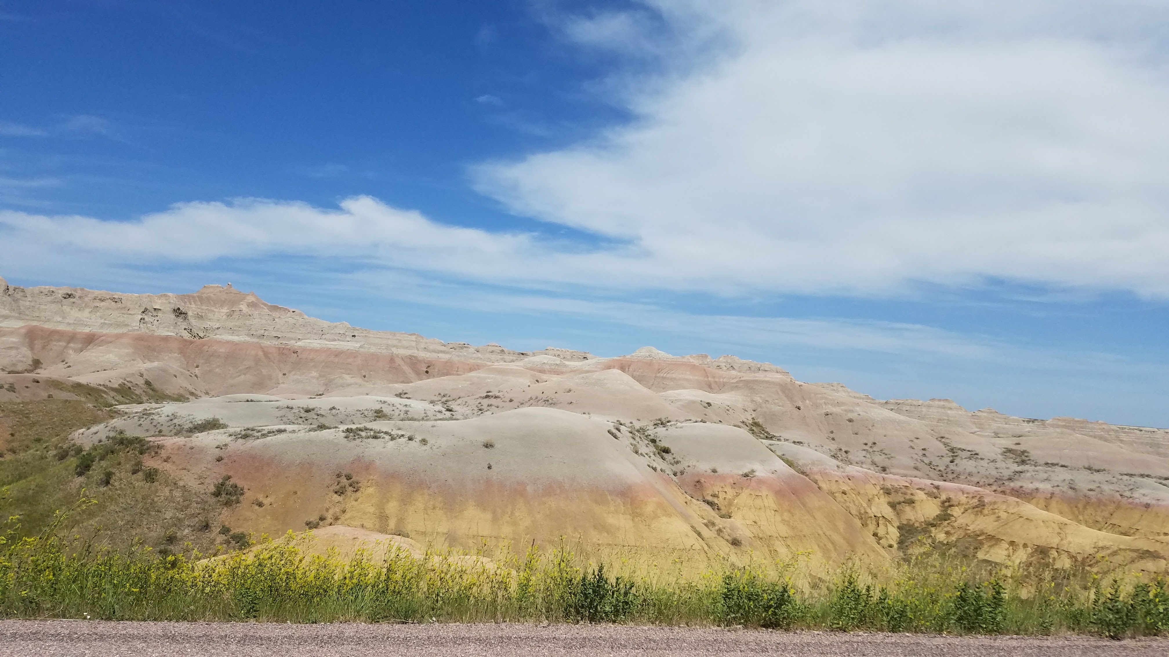
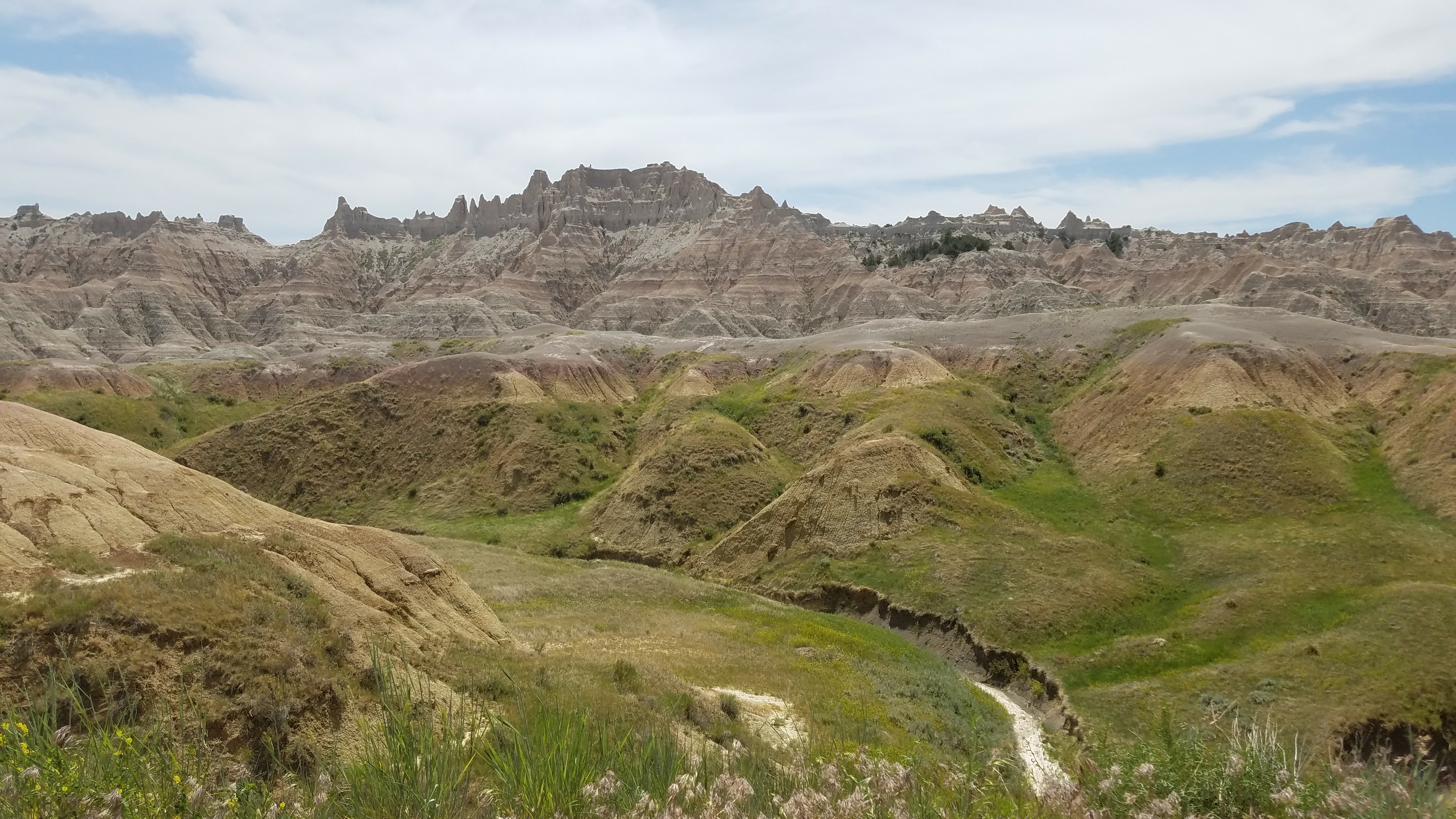
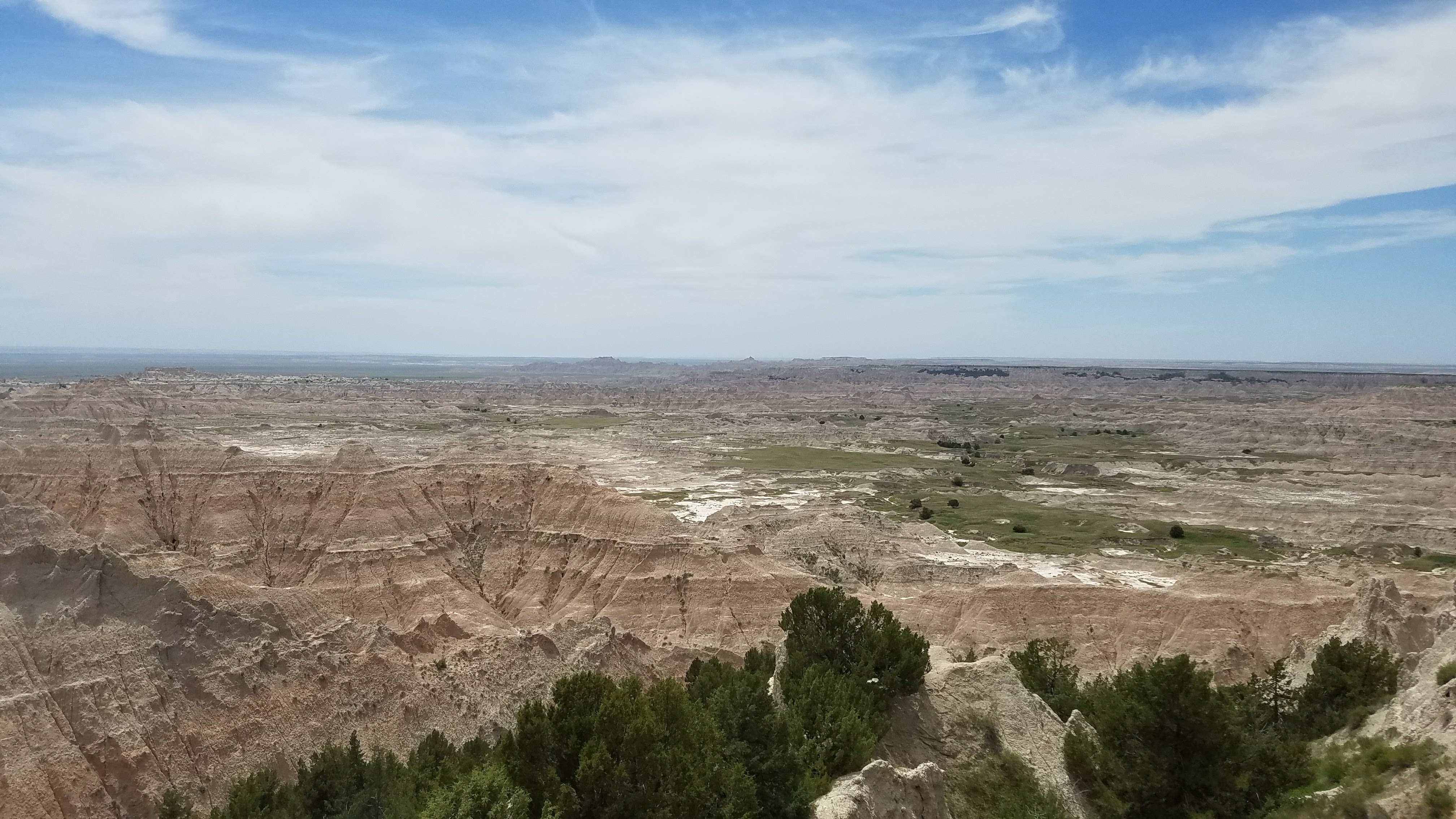
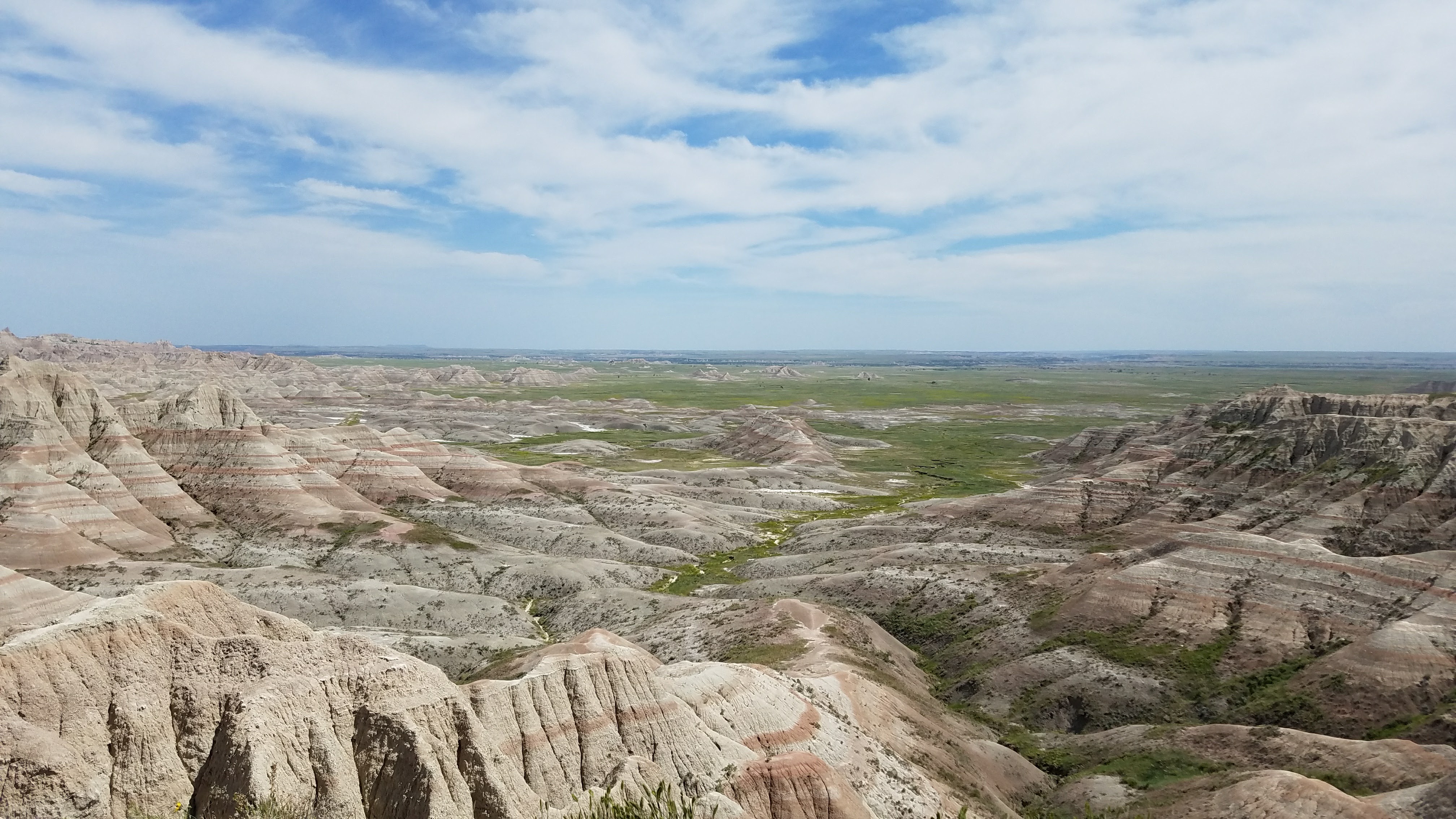
If I had to choose, I would say that the Badlands in North Dakota inspire just a little more awe than the Badlands in South Dakota. The interesting thing is that most people don’t know there is also Badlands in North Dakota. That aside, what I saw of the 300+ square miles of protected land was still amazing. Though the day we went through, the temperature got up well over 100 degrees. The Badlands got it’s name from lack of water and extreme temperature (amongst other things). That day held true to the namesake as it was hot (over 100 degrees) and the air conditioning stopped working shortly after we got in to the park. That didn’t take away from the incredible sights surrounding us that the Badlands had to offer. Similar to the Badlands in North Dakota, everything felt like someone just dried up an ocean and you could walk around (which is basically what happened anyway). There are still lots of places left to explore to look for undiscovered fossils. There are even remnants of early American homesteaders. But all of this stuff was a little off the beaten path and it was way too hot to go exploring that day. The color variations in the mounds represent the leftover minerals as the oceans dried up. For example, when you see white with a thin gradient of dark red, it’s more than likely leftover iron (amongst some other elements) from the water evaporating.
Mount Rushmore and Hail
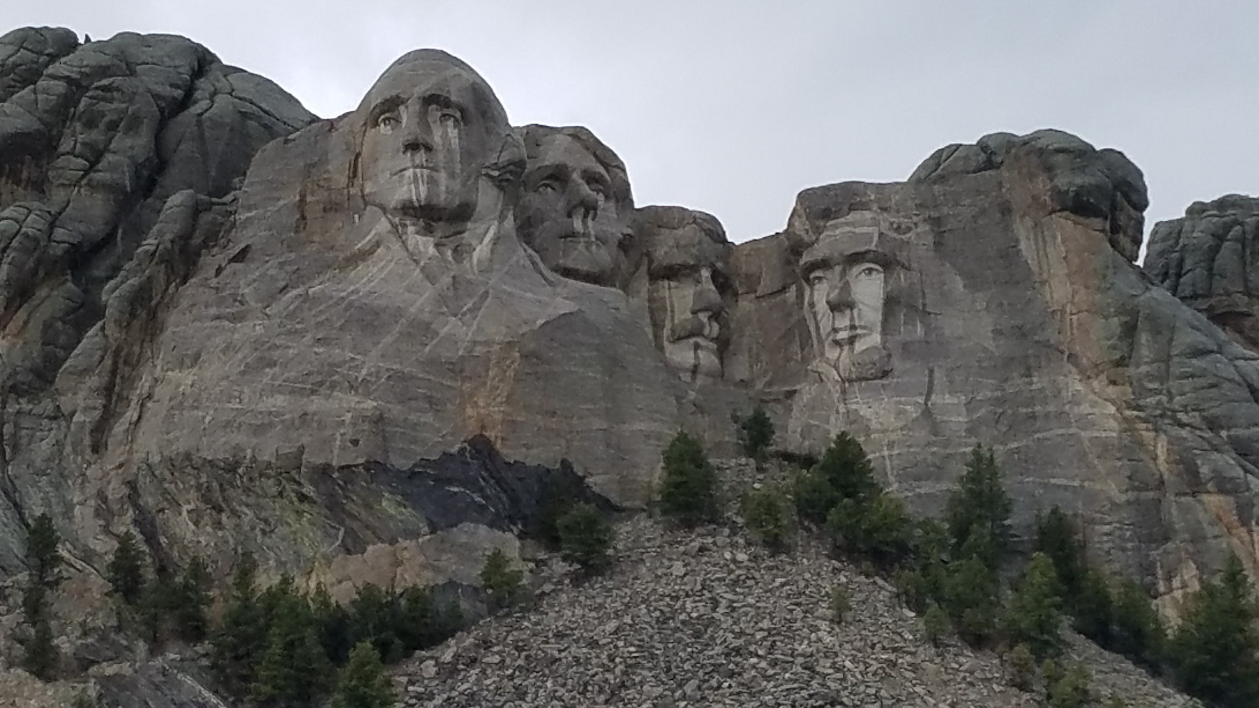 On the way up to Mount Rushmore (which is a great drive through beautiful scenery), it went from 75 and sunny to a hail storm out of (what seemed like) absolutely nowhere. This is apparently common in these parts of the US. The temperature dropped roughly 15 degrees in less than 10 minutes and down it came. But once I got through the hail and got to the actual Mount Rushmore, only 2 things actually struck me. One, this is cool, but it isn’t really all that impressive. Two, this would never be allowed to happen in today’s world. There would be way too much environmental push back and far too much partisan politics. It was worth it to go to Mount Rushmore to see what it was about. But it’s still hard to get a feel for exactly how big four 60 foot stone heads is. It was originally supposed to be from head to waist, but (thankfully) a lack of funding prevented anything but the heads of the four presidents: George Washington, Thomas Jefferson, Abraham Lincoln, and Theodore Roosevelt.
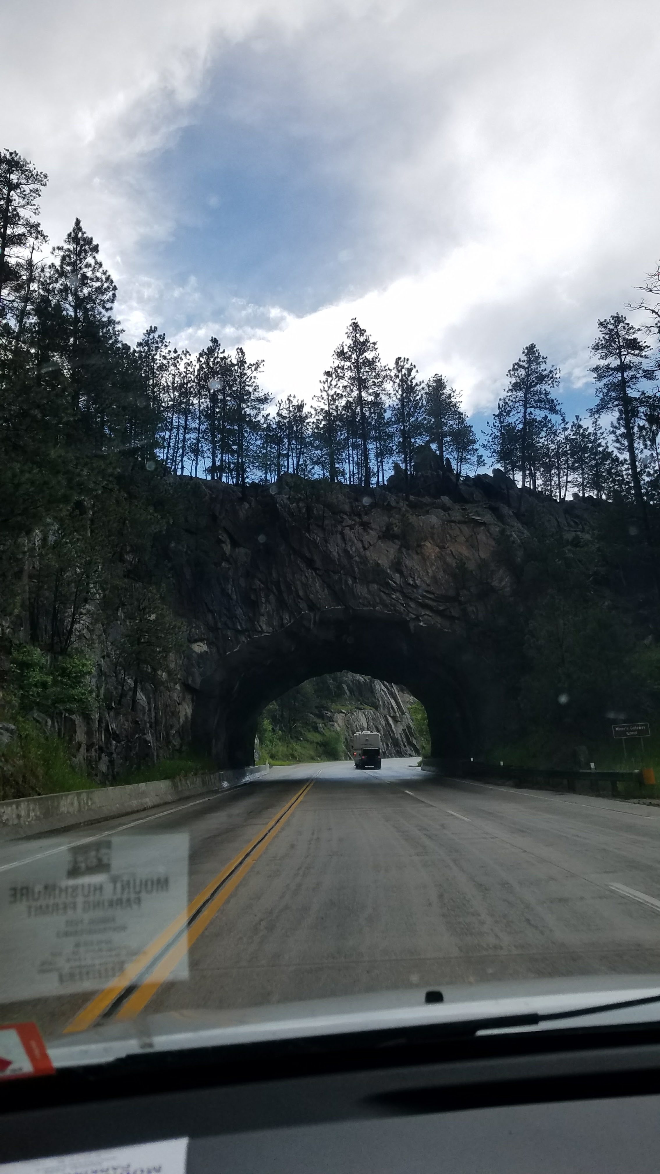
Needle Highway and Black Elk Peak
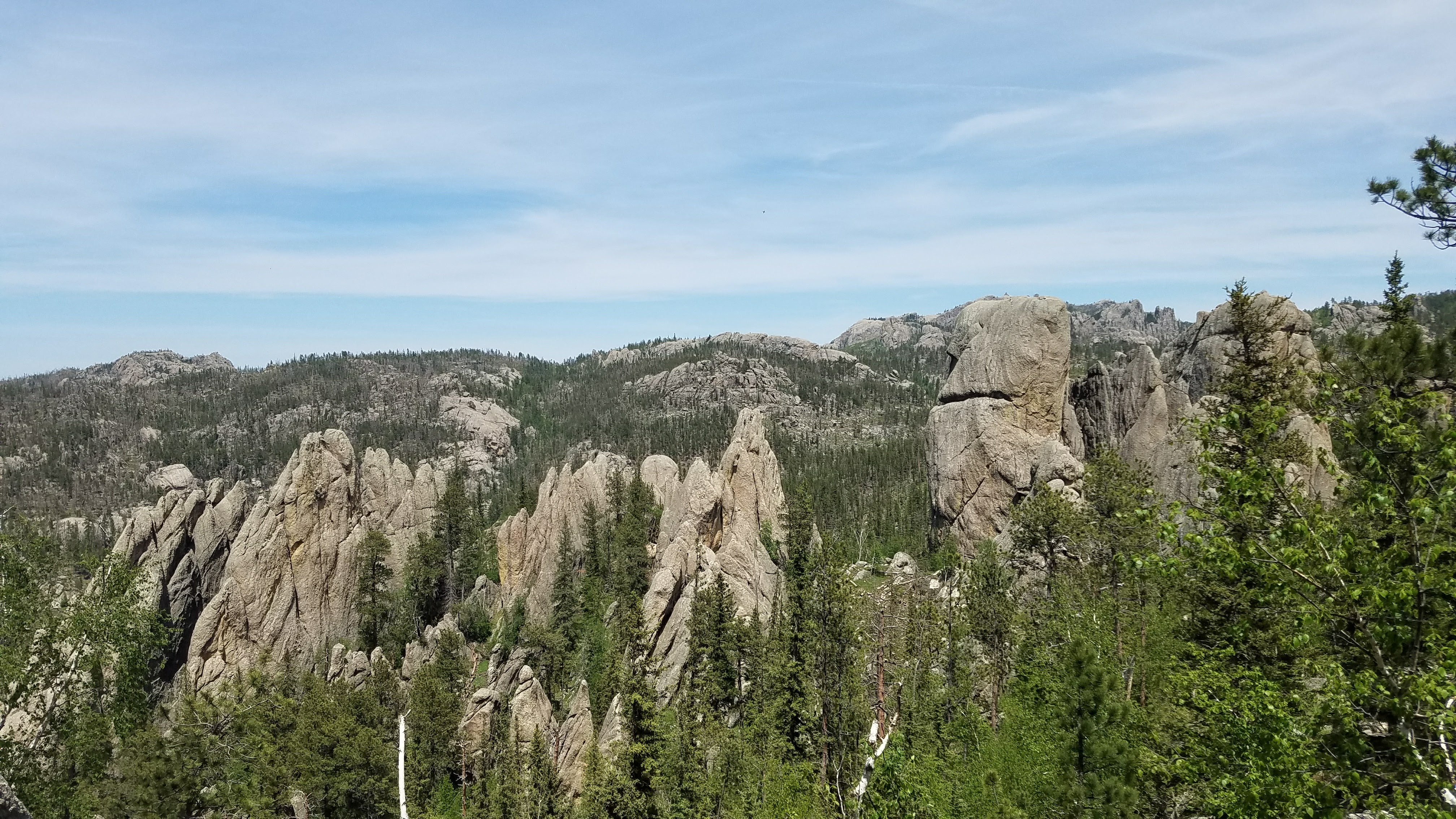
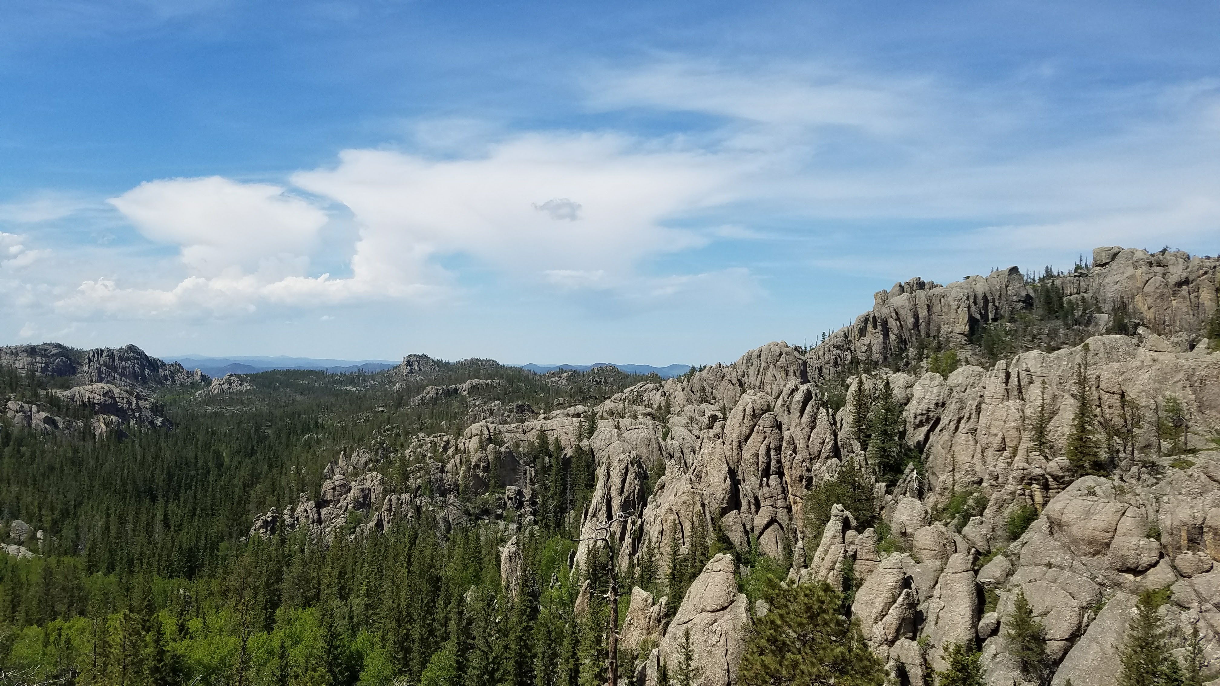 The Needle Highway, also known as South Dakota Highway 87, is a very pretty and potentially dangerous stretch of highway. It is a really curvy road that takes you fairly high up in to the mountains with some steep cliffs right off the edge of the road. It’s potential for danger is so high that it’s not even open in the winter. But when it’s open, this stretch of road presents you with a beautiful view of Custer State Park. The view from the picture is from the trail leading up to Black Elk Peak (formerly known as Harney Peak). Black Elk Peak is the highest natural point in South Dakota at over 7,200 feet (the specific number varies depending on whose measurement you accept and apparently there is some controversy here). This peak is where the Oglala Sioux medicine man Black Elk received his great vision which was eventually turned in to the famous book, Black Elk Speaks in 1932. They also used to have a watchtower up there to keep fire watch since one can see for many miles in all directions on a clear day.
Chosen Ones

The whole gallery of pictures from Western South Dakota is available on Google Photos.

Eric, your trip is so interesting. I love the detail you’re including. Keep me coming!
Thanks, glad your enjoying it. I’ll be on the road for at least a few more months. So there is a lot more to come.