On my way through Wyoming, I stopped in a few towns a little off the beaten path. The first of such places was Sundance, Wyoming. I spent the night drinking and watching UFC fights with some wild land fire fighters. They made a few great recommendations about where to go in Wyoming and Montana. They also drink a lot and apparently this particular group liked to make the entire bar dance when certain songs came on and wouldn’t take no for an answer. It was all in all a really good time hanging out with this group of badasses. Taking them up on some of the recommendations, we went to Devil’s Tower and the Big Horn Mountains. We also got a few more suggestions from some of the local folks in Gillette and Sheridan, Wyoming on some cool local hikes.
Gillette
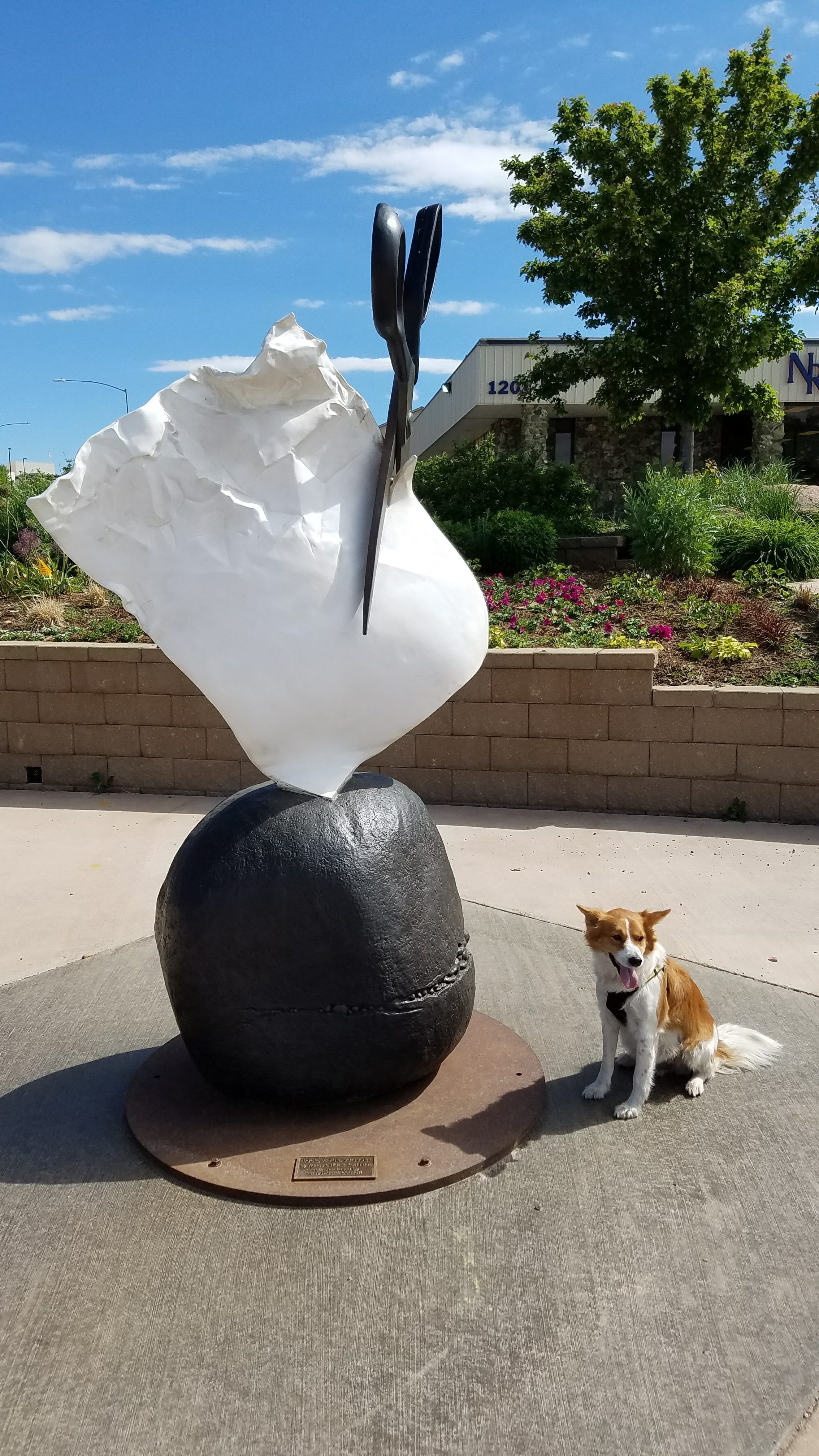
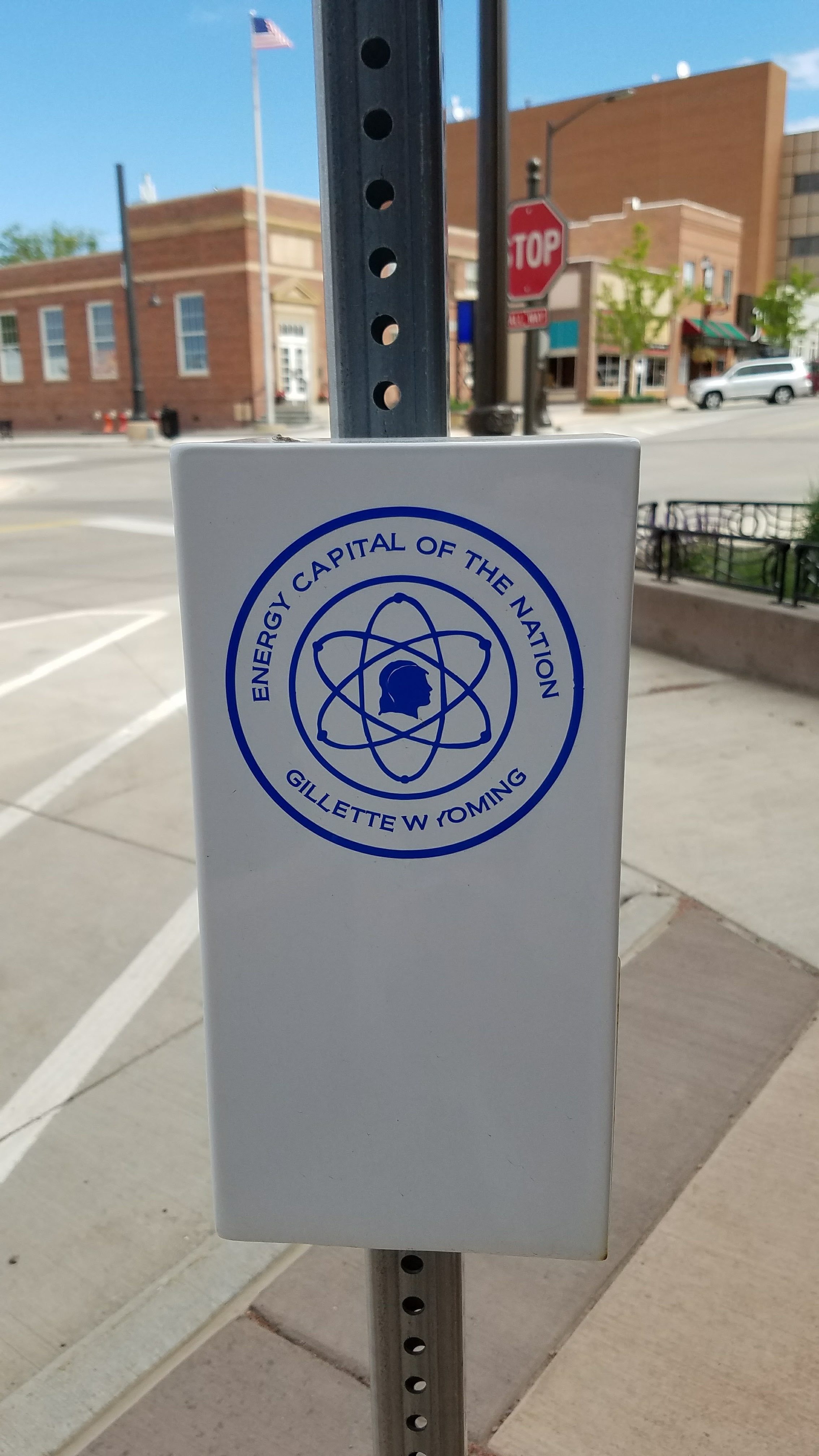 On the way towards Devil’s Tower, I saw a sign for an antique car museum and decided to pull off the highway to take a look. Even with following the signs and trying with the GPS, I couldn’t find the museum. So I did what most people would do, I went to the open ice cream shop. What I found out about Gillette, Wyoming is that it calls itself the “Energy Capital of the Nation.” They are the largest coal producer in the state of Wyoming. The state of Wyoming is the largest coal producer in the US accounting for over 40% of the coal mined in the US. I ended up sitting outside having ice cream and talking for about 2 hours with some folks who work in the coal industry and coal support jobs. It was really interesting to hear about coal and where they think it’s place is in the future of the US economy. It appears that even coal miners believe coal is a dying industry. They aren’t in denial over it either. They just want to know that they will be supported when the coal business turns to dust (so to speak). According to the folks I was chatting with, this is what most people in the “Energy Capital of the Nation” believe. It’s just a matter of them not feeling like they are left behind when the tide turns to cleaner forms of energy. Gillette also had a cool “Rock, Paper, Scissor” statue. Not sure what it was about, but it was entertaining.
Devil’s Tower
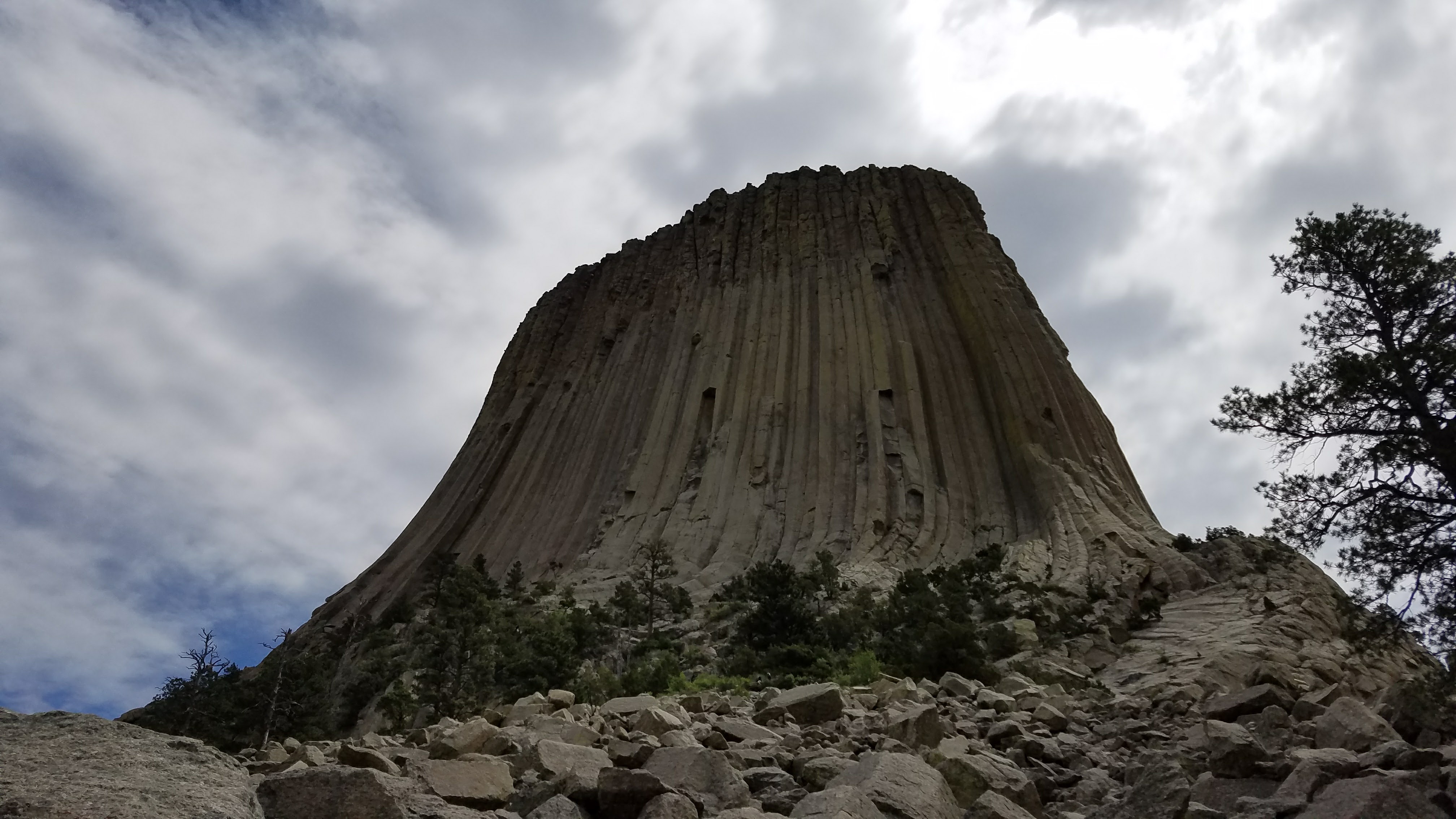
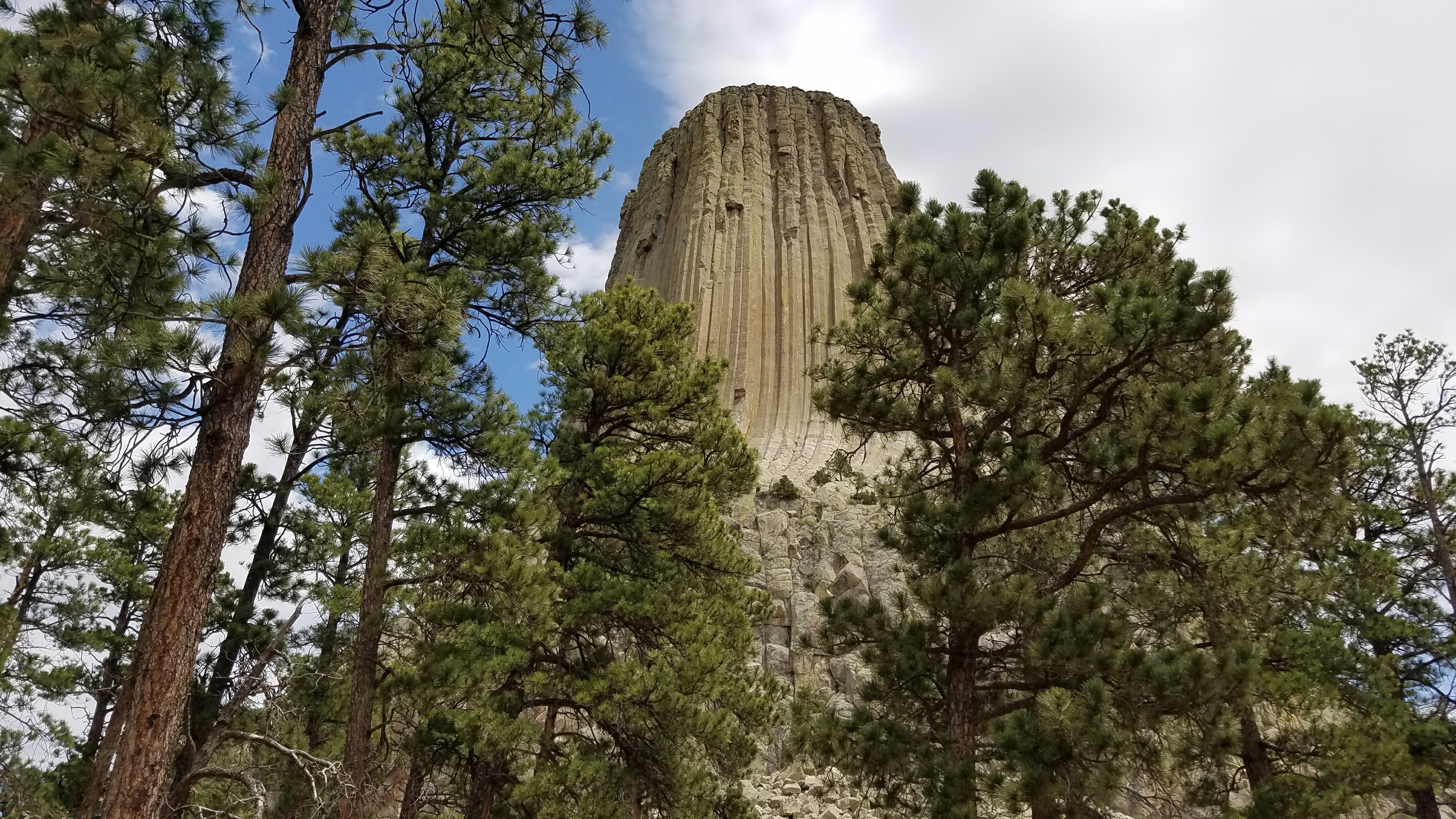 The first national monument ever declared in the United States was Devil’s Tower in 1906. It’s a 1,267 foot tall Laccolith Butte. A Laccolith Butte is a fancy way of saying a rock stuck between two other rocks that has a flat top and is basically by itself. Interestingly, roughly 1% of the roughly 1 million people who visit the tower each year show up to climb it. Though there were very few climbers while I was there given it was June. This is because the plains Indian tribes like the Lakota, Cheyenne, and Kiowa find the rock sacred and didn’t want anyone to climb it. Since the rock was considered to be on national land, climbers argued that they should be allowed to climb the mountain whenever they want and that the government should stay out of religious affairs. Now roughly 85% of people honor a voluntary ban of no climbing in June. The other 15% seem to be assholes (I met a bunch of them in person and can personally verify that). The name Devil’s Tower is also a bit of a misnomer. It was actually a mistranslation from the first American who discovered it. His translator misunderstood the name as “Bad Gods Tower.” Later the name was shortened to Devil’s tower and as is customary for national parks, the apostrophe was removed for consistency. It’s more commonly referred to by the local tribes under a variety of names mostly having to do with Bears (Bear Lodge, Bear Tipi, Home of the Bear, etc).
Tongue River Canyon
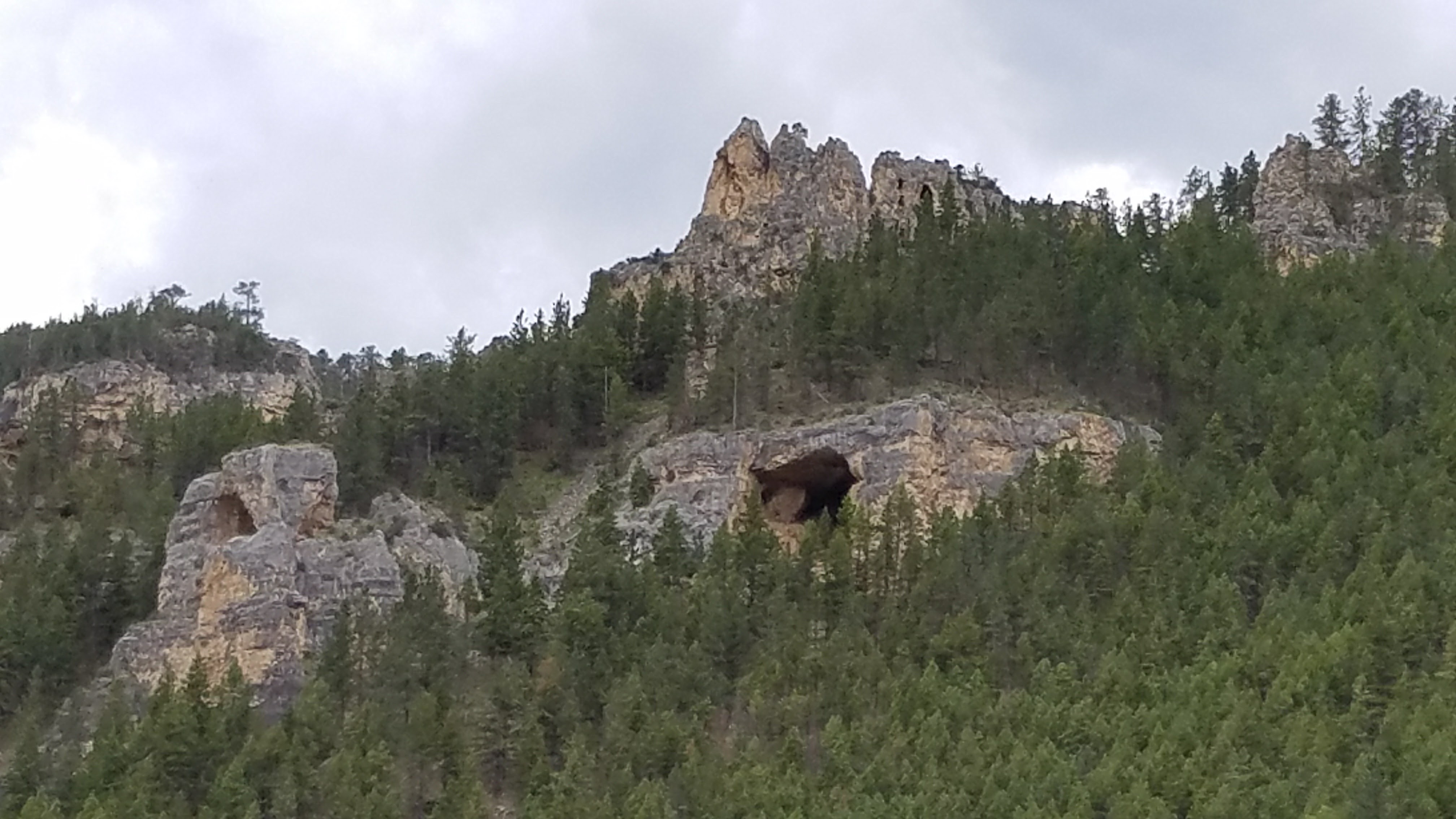
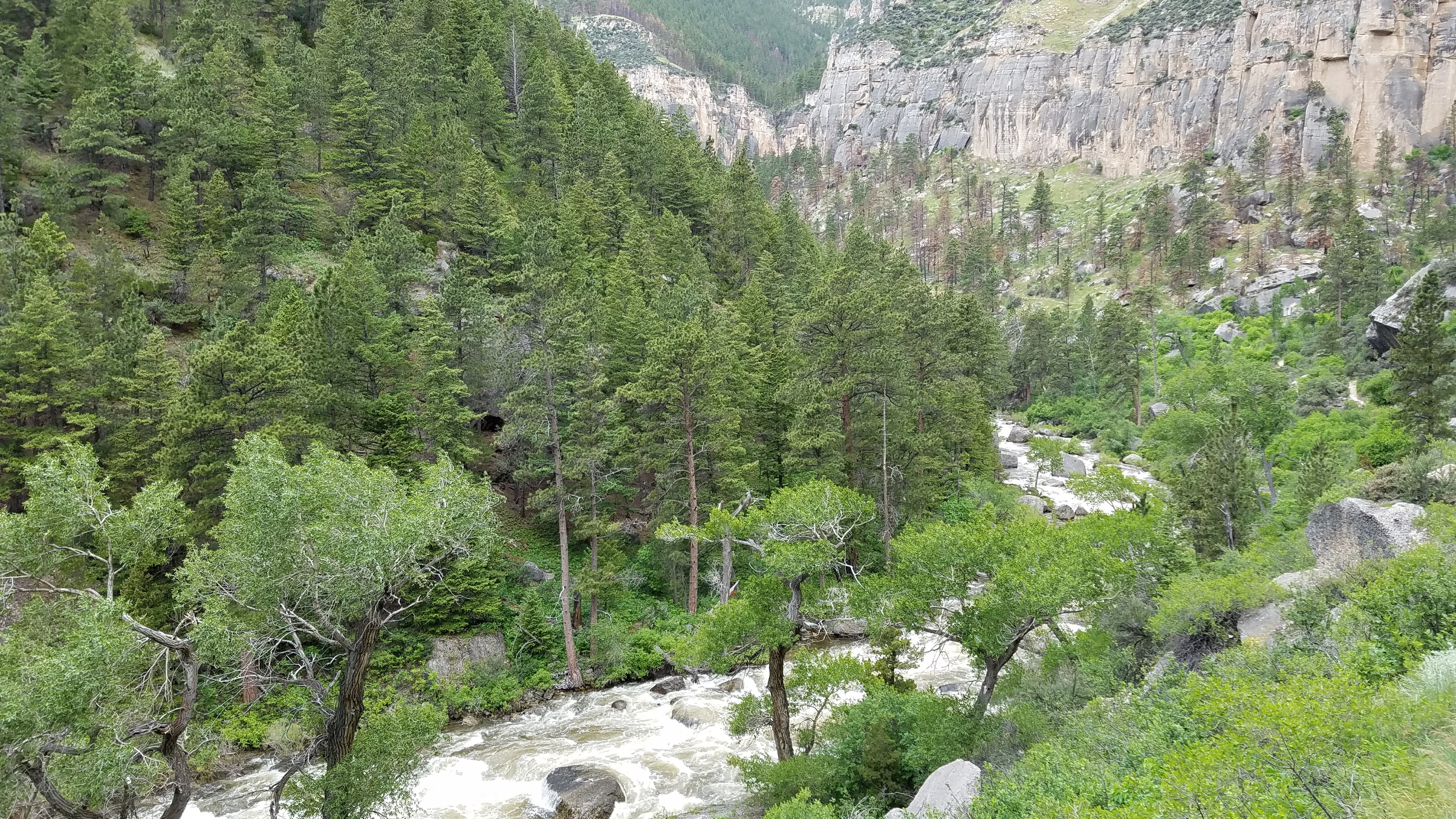 After chatting with the folks in Gillette and asking for ideas on what to see other than Devil’s Tower, I was told I needed to spend a day in Sheridan, Wyoming. Sheridan is an awesome little town that sits near the base of the Big Horn Mountains. As the weather gets warmer, it becomes a bit of a tourist town for polo players. Polo players, as I realized, generally dress like golfers, just with slightly different pants. While I was hanging out at a bar in town, I met a few folks who suggested that I check out the Tongue River Canyon. The Tongue River is a river that is created by winter snow pack. This means that as more snow melts, the rivers gets fed more water and cuts deeper in to the basin. The Tongue River Basin, which is part of the larger Powder River Basin runs from the Black Hills (in the Dakotas) west to the Big Horn Mountains. The space in between the mountain ranges makes for some incredible views.
Big Horn Mountains
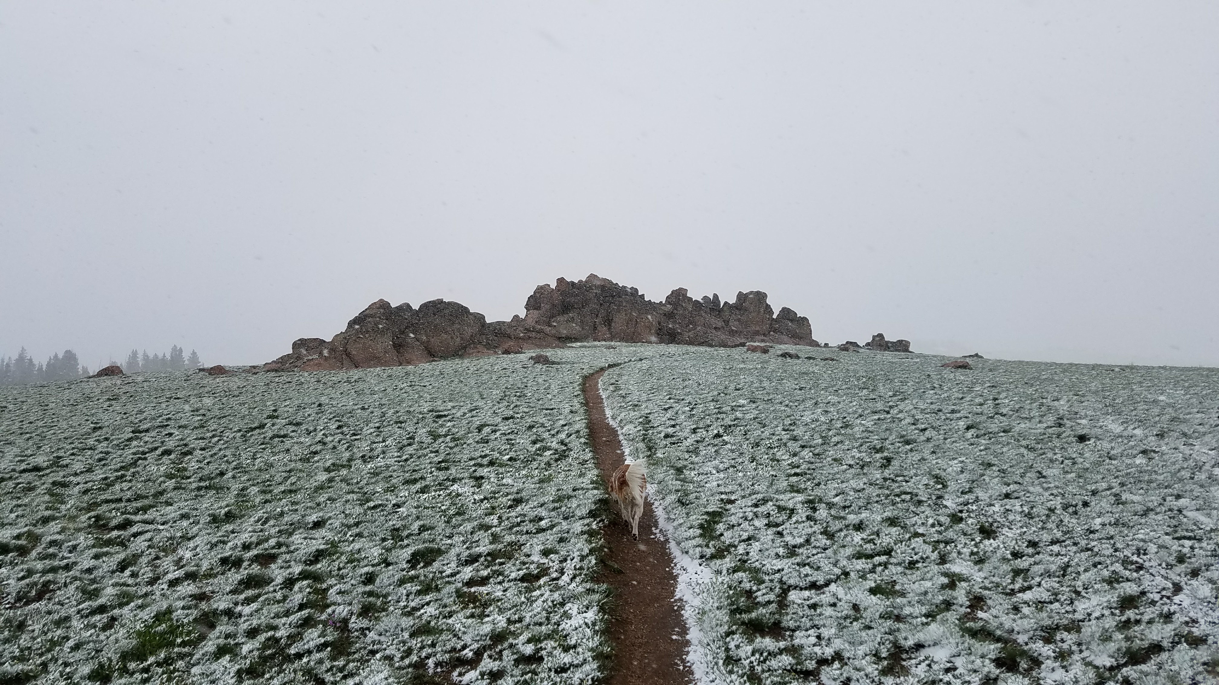 Before heading from Wyoming in to Montana, I decided to take the long way from Sheridan, Wyoming through the Big Horn Mountains to Montana. This was on route 14A (A for alternate). The non-alternate route would take you to Yellowstone. At the base of the mountains, it was roughly 80 degrees Fahrenheit. When we got to the top of the mountains, we hit a really nasty snowstorm and the temperature turned to about 25 degrees Fahrenheit over only a few short miles. The snowstorm was so bad that I could barely see past the front of the hood of the car. I would have taken a picture, but the roads through the mountains were, at times, on a cliff edge and I didn’t want to risk driving off a cliff just for a good picture. The drive itself though the 70 million year old mountain range was otherwise incredibly beautiful. What’s really cool about these mountains is that basically anywhere you go, there is glacial remnant like lakes, rivers, and streams. There is still an active glacier in the mountains and it’s the only one remaining in the entire Big Horn Mountain Range called Cloud Peak Glacier.
Chosen Ones